
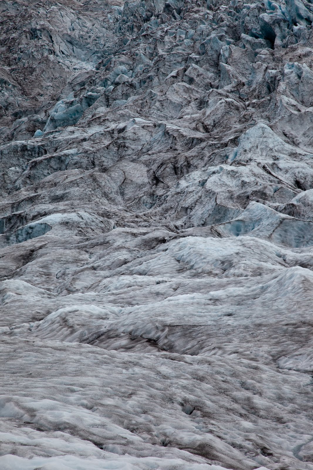
After showering (these times 5 minute showers are feeling long now - no need to rush so much!), packing up and moving the car, we joined Glacier Guides for a drive to one of the local glacier tongues for a 7 km hike on the ice. With crampons strapped to our feet, harnesses around our hips (just in case) and orange helmets on our heads (also, just in case), we walked up the glacier, learning about black ice (a volcanic ash layer from past eruptions, it protects the ice so it will melt slower here), the flow of the glacier (it is melting at 10 cm or so per day from the surface, and moves downhill about a metre per day), crevasses (which form where the slope is steeper and the flow is faster, and then close up again where the slope is less steep). Stunning to see.
We were supplied with a ham cheese salad sandwich and an orange fruitbox on the ice, then made our way across the ice before heading back down after a 4 hour tour. (It was funny to just get handed them - no choice, no enquiry as to allergies or preferences. Just some lunch, supplied, as per the brochure.) A short drive to Jokulsarlon for an amphibious boat ride amongst the icebergs. This time, we drove further along the road and over a bridge across Iceland’s shortest river (it is maybe 50m long, from the lagoon to the sea), that had small icebergs in it, and some washed on the black sandy beach.
On the way back to the national park, we pulled over at another glacier, also with a lagoon in front. This one was used for tours earlier in the summer, using Zodiac boats to get across to the ice. Unfortunately, where ever they parked the boats, invariably the icebergs would drift to ice it in, so they had abandoned these tours until next year, when they will have 2 boats that can be moored on 2 different parts of the shore.
After a full day’s turing and exploring it was back to the carpark to pick up the camper and head west to the small town of Skogar where we would camp. On the way we passed through Vik to photograph the famous church high upon a hill in the middle of town. In the last eruption is this area the church was the only building to survive as the floodwater and lava rumbled down the hill. Next stop was Dyrholaey, a small headland along the beach with a large natural arch that rose from the sea flow. Some nice photos of the arch and accompanying lighthouse completed this leg.
We arrived at Skogar after sunset to setup up camp in the shadow of the waterfall, Skogarfoss, nestled at the base of Eyjafjalljokull. Dinner was a simple affair of cup-o-soup and noodles as we listened to the hundreds of sheep in the paddock nearby bleating late into the night. Another long day of hiking, driving and sightseeing. It is now dawning on us that the adventure is very quickly winding up and we will be to home soil in no time.


No comments:
Post a Comment