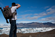
After some early (and cold!!) shots of the waterfall here, we drove around to Seljandsfoss - a beautiful water fall that we are able to walk behind. We realise the best shots would have been last night into the setting sun, but it was not to be. A few hundred metres up the road, we find a waterfall hidden behind a small canyon, then continue up the road to Thorsmork. This is a beautiful area, and the end point of a 30 km hike from Skogar, or the start point for a 4 day hike to Landmannalaugar. We drive along the river flood plain, all covered in ash from this years eruption. The glacier itself is also almost entirely black with ash, but still steaming in places. It is pretty cool to see this famous volcano up close - but interesting to realise that this volcano is so insignificant compared to its neighbours that it is only named for the glacier on top of it - all glaciers are ‘jokull’, and all the big glaciers have at least one volcano underneath - Vatnajokull has 5 active ones. Katla is under Myrdaljokull and is one of the big ones due to go at anytime - it usually follows Eyjafjalljokull by a matter of months, and Hekla nearby is also due to go off around now.
The road to Thorsmork disappeared under the river near the hut and start point of walks, and after consulting the guide book we decided that what was on offer was not worth this deeper and scarier looking river crossing - we did around a dozen anyway, and the last few had been deeper than we liked. The wide flood plain was covered in deep ash, and there were extensive road works in places, obviously repairing damage sustained this year. All the bridges around here are very simple affairs - I guess the Icelandic philosophy is to build the bridge strong enough for the traffic, knowing it will need to be rebuilt after flood or volcano damage, rather than trying to withstand these enormous natural forces.
After making our way back to the Ring Rd, we keep heading west, towards Reykjavic. We stop for some fuel (all $2 per litre - more than at home, but really, petrol in Europe was $2 per litre 15 years ago, so I figure we are doing ok. Then again, it adds $700 to our costs), and Charlie samples a hotdog - a dog wrapped in bacon, with crispy fried onion, raw onion, mustard and tomato sauce. He wanted to get three! Interestingly, our purchase of a yogurt, a drink and the hotdog is only $6.50 - we are starting to think we have had the wool pulled over our eyes - Australia is actually getting really expensive.
Mind you, had we been here 2 years ago, the exchange rate was much worse - $1 is 100 kronur - very easy conversion, but then, $1 was only 50 kronur - petrol would have been $4 per litre. Ouch!! At Selfoss, we turn inland, but get distracted by yet another modern church. This one is the traditional shape, clad in blue tin, with enormous rectangular windows capturing the view and the sunlight. When we stop the car to have a look around, we can hear a woman singing inside - very operatic style. Another magical moment. Continuing on towards Gullfoss, one of the most famous waterfalls in Iceland.
We have perfect weather - sun, big clouds, a rainbow arching through the mist over the falls, and all captured in megapixels. A beautiful setting, with a raging, roiling river disappearing through a narrow canyon below. Next stop is Geysir - the original geysir for which all others are named. Sadly, she doesn’t blow anymore. In the 1950’s, some tourists threw rocks into it, blocking the water flow. It has spouted water a few times since, but only for a time after local earthquakes (we were told yesterday that there are 30 - 100 earthquakes measured in Iceland everyday, but most are smaller than we can feel. Mind you, we both thought we felt one last night). Fortunately, it’s little sister, Strokkur, erupts every 5 - 8 minutes. We watch the steaming water eddy and bubble, before a big blue bulge appears and it erupts, many stories high (I can’t really tell, but it looked to be more than 4 stories). A couple of spouts that we saw were followed quickly by another smaller spout - perhaps house high. A very spectacular little geothermal field.
We then make our way to Thingvellir - one of the most important historical and natural sites in the country. This was the site of the original parliament, in a natural amphitheatre. It is also an area where there are many fissures and cracks, again the result of the these two northern tectonic plates pulling apart. The campsite here is surprisingly barren - no power, but free hot showers and a free washing machine. We are huddled in the laundry room because it is the only place with a powerpoint! And it is warm. With no power, our heating in the van won’t blow for long, so we’ll save that for bed time. We have done 2500km in our car so far, some of the wheels look a bit haggard after some of the terrible roads we have traversed, and our fridge smells evil, but we have had a great time. Tomorrow - a walk around here, and we’ll make our way back towards Reykjavic, the blue lagoon, ready to return the car on sunday.


Steam rising from Eyjafjallajokull. The black areas is actually the Glacier covered in ash.


No comments:
Post a Comment