Thursday, September 2, 2010

Day 11 : Thingvellir to Reykjavic

After a cold night at the Thingvellir camp ground we set out on a 8km hike through the fissures and lava fields of the area to explore Iceland’s most important historical region. Thingvellir was the site of Iceland’s first parliament in started in the year 930 AD. The original settlers would travel from all the reaches of Iceland, sometimes up to a 2 week journey to reach the site to discuss and enact new laws, serve justice upon criminals and outlaw people and lay the foundations of the new land. Only small foundations of the original budir (booths) remain. The small stone and turf huts served as shelters for the parliament goers and they acted like stalls at todays music festivals - selling food and drink. There were performers, food vendors and entertainers for the 2 week period each year the parliament sat. As we walked around the area we tried to imagine the original inhabitant viking types in this rugged land of ancient fissures, lava fields and waterfalls. The original amphitheatre was a 30ft high wall of basalt that, over time, had risen from the surrounding landscape at a rate of 2 inches a year.


After our history lesson we headed south towards Reykjavik with a slight detour to a geothermal power plant, Nesjavellir, that provides Reykjavik with hot water and green energy. It was an interesting walk along the gangway that let visitors view the operating plant. Many signboards later we pretty much knew everything there was to know about geothermal. Fact 1: The power plant releases the same amount of CO2 in one year as a coal fired station would in 7 days. Fact 2: The entire Icelandic fishing fleet release the same C02 in 10 days! Clearly a clean energy source that is abundant in Iceland.


After the power plant our mission was to try and capture (in digital film) the elusive Puffin. Our trusty Lonely Planet guide directed us to a rocky cliff outcrop in the south of the country, a nesting and breeding ground of this parrot faced penguin bird. After traveling the ‘white grade’ road for several km our memories of the midway point of our holiday came flooding back. We were in no mood to search too far for this bird, especially this late in the season when they have likely all headed south for the winter. After arriving at the coast, a cursory look for 5 mins produced no gold - only seagulls - so we hopped back in the camper and resumed our original mission, which was to visit the famous Blue Lagoon.


After our experience of the Myvatn Nature Baths our expectations were high. The Blue Lagoon represented the pinnacle of Icelandic Tourism marketing. It was mentioned everywhere - and it is said that 90% of all visitors to Iceland come to experience the soothing mineral laden waters of the lagoon. At $50 person that represents $20M a year for a lava rimmed lagoon, filled with waste water from the nearby power plant, clever and effective marketing. That does simplify the experience somewhat, the setup was second to none. Shower facilities, lockers activated by a bracelet that you wore while in the pool that even had $50 bar credit on it. The credit could be used at the lagoon bar for beers, krushies and even Blue Lagoon cocktails . . . nyuk nyuk.


The waterfall pummeled and massaged your shoulders (the guide book described this as feeling like being massaged by a troll - I laughed at how true this was when I was under it’s thundering flow), silicate mud was abundant and used to create a natural face mask to exfoliate and moisturise your skin. There were steam rooms, a steam cave ‘grotto’, Lagoon bar and café and a fumerole that vented hot steam whilst you floated along the mineral rich waters. For all it’s hype, it wasn’t as good as the cheaper version in the country. It wasn’t as deep or hot as before and the glare from the sunny day, strangely enough, took something from the experience. The rainy cold and misty experience last week was far more otherworldly.


We left at 5.30pm and made our way back to the Reykjavik Camp Ground. Driving on the right hand side of the road, negotiating roundabouts and tricky intersections is coming naturally to me now and I feel practically like a local.


After a rest we headed into the Reykjavik city centre for a sample of the night life. At 11.00pm we felt like we were too early what was reputed as a party town. Nevertheless, we had a couple of beers, ate a famous Icelandic hotdog as described in our guide (from a stall near the harbour where Bill Clinton bought one! It was very tasty, and again, cheap - $9 for 2 hotdogs and 2 drinks) and walked the return 7km journey back to the campsite.



Monday, August 30, 2010

Day 10 : Skogarfoss to the golden circle, via Eyjafjalljokull

After some early (and cold!!) shots of the waterfall here, we drove around to Seljandsfoss - a beautiful water fall that we are able to walk behind. We realise the best shots would have been last night into the setting sun, but it was not to be. A few hundred metres up the road, we find a waterfall hidden behind a small canyon, then continue up the road to Thorsmork. This is a beautiful area, and the end point of a 30 km hike from Skogar, or the start point for a 4 day hike to Landmannalaugar. We drive along the river flood plain, all covered in ash from this years eruption. The glacier itself is also almost entirely black with ash, but still steaming in places. It is pretty cool to see this famous volcano up close - but interesting to realise that this volcano is so insignificant compared to its neighbours that it is only named for the glacier on top of it - all glaciers are ‘jokull’, and all the big glaciers have at least one volcano underneath - Vatnajokull has 5 active ones. Katla is under Myrdaljokull and is one of the big ones due to go at anytime - it usually follows Eyjafjalljokull by a matter of months, and Hekla nearby is also due to go off around now.


The road to Thorsmork disappeared under the river near the hut and start point of walks, and after consulting the guide book we decided that what was on offer was not worth this deeper and scarier looking river crossing - we did around a dozen anyway, and the last few had been deeper than we liked. The wide flood plain was covered in deep ash, and there were extensive road works in places, obviously repairing damage sustained this year. All the bridges around here are very simple affairs - I guess the Icelandic philosophy is to build the bridge strong enough for the traffic, knowing it will need to be rebuilt after flood or volcano damage, rather than trying to withstand these enormous natural forces.


After making our way back to the Ring Rd, we keep heading west, towards Reykjavic. We stop for some fuel (all $2 per litre - more than at home, but really, petrol in Europe was $2 per litre 15 years ago, so I figure we are doing ok. Then again, it adds $700 to our costs), and Charlie samples a hotdog - a dog wrapped in bacon, with crispy fried onion, raw onion, mustard and tomato sauce. He wanted to get three! Interestingly, our purchase of a yogurt, a drink and the hotdog is only $6.50 - we are starting to think we have had the wool pulled over our eyes - Australia is actually getting really expensive.


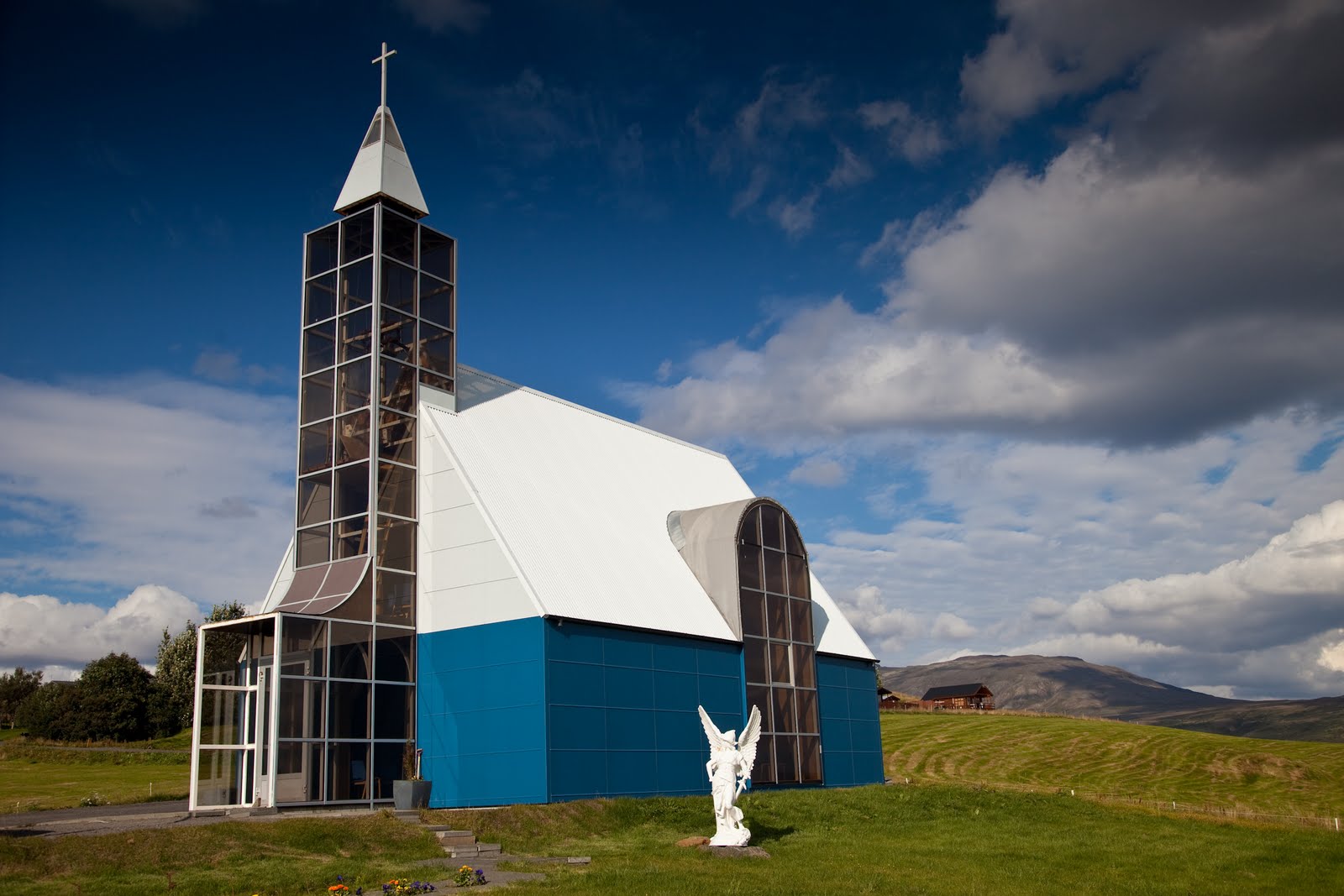
Mind you, had we been here 2 years ago, the exchange rate was much worse - $1 is 100 kronur - very easy conversion, but then, $1 was only 50 kronur - petrol would have been $4 per litre. Ouch!! At Selfoss, we turn inland, but get distracted by yet another modern church. This one is the traditional shape, clad in blue tin, with enormous rectangular windows capturing the view and the sunlight. When we stop the car to have a look around, we can hear a woman singing inside - very operatic style. Another magical moment. Continuing on towards Gullfoss, one of the most famous waterfalls in Iceland.


We have perfect weather - sun, big clouds, a rainbow arching through the mist over the falls, and all captured in megapixels. A beautiful setting, with a raging, roiling river disappearing through a narrow canyon below. Next stop is Geysir - the original geysir for which all others are named. Sadly, she doesn’t blow anymore. In the 1950’s, some tourists threw rocks into it, blocking the water flow. It has spouted water a few times since, but only for a time after local earthquakes (we were told yesterday that there are 30 - 100 earthquakes measured in Iceland everyday, but most are smaller than we can feel. Mind you, we both thought we felt one last night). Fortunately, it’s little sister, Strokkur, erupts every 5 - 8 minutes. We watch the steaming water eddy and bubble, before a big blue bulge appears and it erupts, many stories high (I can’t really tell, but it looked to be more than 4 stories). A couple of spouts that we saw were followed quickly by another smaller spout - perhaps house high. A very spectacular little geothermal field.


We then make our way to Thingvellir - one of the most important historical and natural sites in the country. This was the site of the original parliament, in a natural amphitheatre. It is also an area where there are many fissures and cracks, again the result of the these two northern tectonic plates pulling apart. The campsite here is surprisingly barren - no power, but free hot showers and a free washing machine. We are huddled in the laundry room because it is the only place with a powerpoint! And it is warm. With no power, our heating in the van won’t blow for long, so we’ll save that for bed time. We have done 2500km in our car so far, some of the wheels look a bit haggard after some of the terrible roads we have traversed, and our fridge smells evil, but we have had a great time. Tomorrow - a walk around here, and we’ll make our way back towards Reykjavic, the blue lagoon, ready to return the car on sunday.


Strokur Geysir about to blow!


In the shadow of the Eyjafjallajokull, the plain is littered with boulders from past erutptions.
The floodplain under Eyjafjallajokull. Notice the ash still in the foreground.

Steam rising from Eyjafjallajokull. The black areas is actually the Glacier covered in ash.

Sunday, August 29, 2010

Day 9 - Skaftafell, Glacier hike, Jokulsarlon boat ride and a drive to Skogar

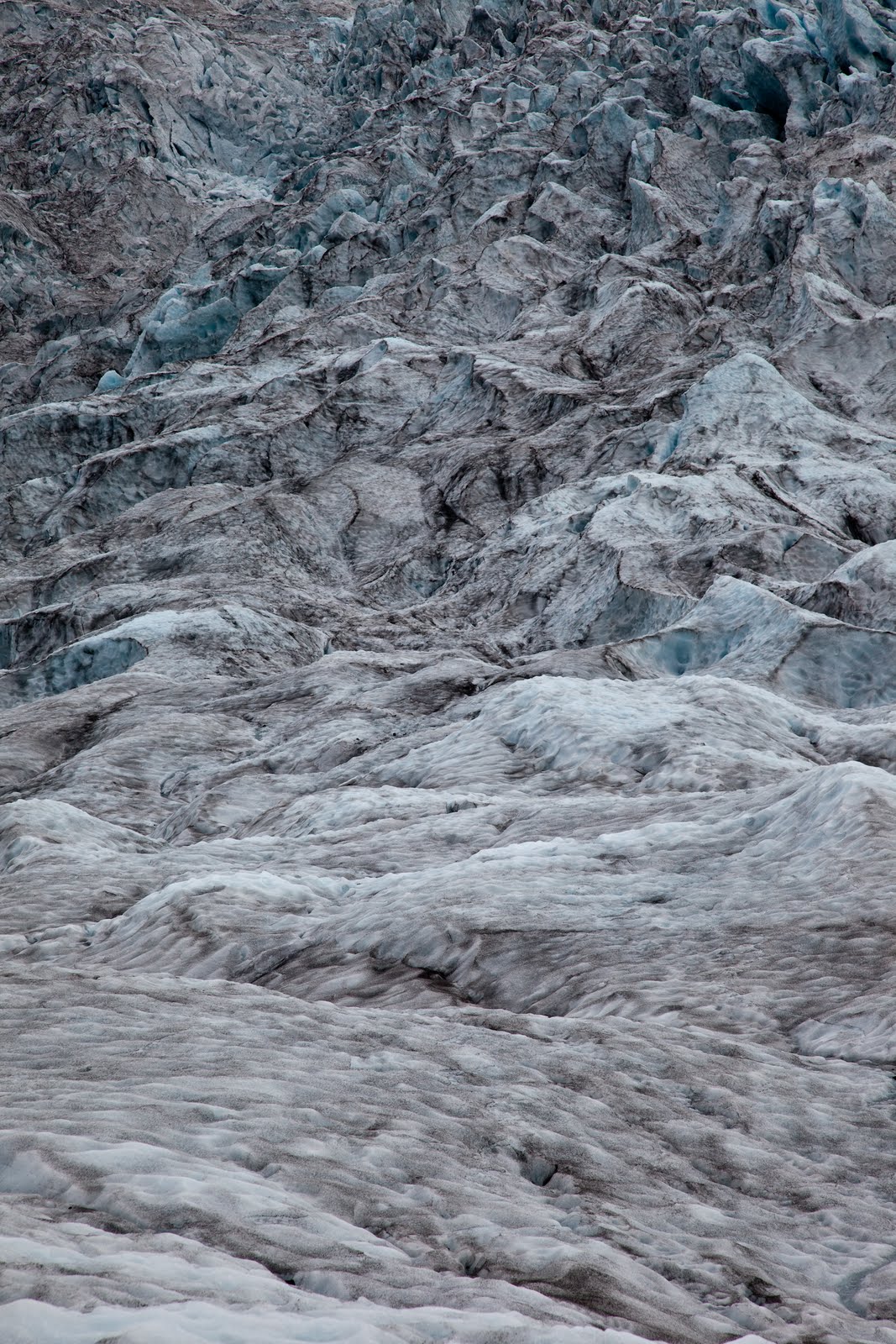
After showering (these times 5 minute showers are feeling long now - no need to rush so much!), packing up and moving the car, we joined Glacier Guides for a drive to one of the local glacier tongues for a 7 km hike on the ice. With crampons strapped to our feet, harnesses around our hips (just in case) and orange helmets on our heads (also, just in case), we walked up the glacier, learning about black ice (a volcanic ash layer from past eruptions, it protects the ice so it will melt slower here), the flow of the glacier (it is melting at 10 cm or so per day from the surface, and moves downhill about a metre per day), crevasses (which form where the slope is steeper and the flow is faster, and then close up again where the slope is less steep). Stunning to see.


We were supplied with a ham cheese salad sandwich and an orange fruitbox on the ice, then made our way across the ice before heading back down after a 4 hour tour. (It was funny to just get handed them - no choice, no enquiry as to allergies or preferences. Just some lunch, supplied, as per the brochure.) A short drive to Jokulsarlon for an amphibious boat ride amongst the icebergs. This time, we drove further along the road and over a bridge across Iceland’s shortest river (it is maybe 50m long, from the lagoon to the sea), that had small icebergs in it, and some washed on the black sandy beach.


On the way back to the national park, we pulled over at another glacier, also with a lagoon in front. This one was used for tours earlier in the summer, using Zodiac boats to get across to the ice. Unfortunately, where ever they parked the boats, invariably the icebergs would drift to ice it in, so they had abandoned these tours until next year, when they will have 2 boats that can be moored on 2 different parts of the shore.


After a full day’s turing and exploring it was back to the carpark to pick up the camper and head west to the small town of Skogar where we would camp. On the way we passed through Vik to photograph the famous church high upon a hill in the middle of town. In the last eruption is this area the church was the only building to survive as the floodwater and lava rumbled down the hill. Next stop was Dyrholaey, a small headland along the beach with a large natural arch that rose from the sea flow. Some nice photos of the arch and accompanying lighthouse completed this leg.


We arrived at Skogar after sunset to setup up camp in the shadow of the waterfall, Skogarfoss, nestled at the base of Eyjafjalljokull. Dinner was a simple affair of cup-o-soup and noodles as we listened to the hundreds of sheep in the paddock nearby bleating late into the night. Another long day of hiking, driving and sightseeing. It is now dawning on us that the adventure is very quickly winding up and we will be to home soil in no time.


Moving icebergs with the Zodiac.
Icecave, formed by the flowing meltwater.


Chipping out 'steps' from the glacier.


Samplng the purest water in Iceland. At .5º it was 'fresh'

Sexxy crampons.


The view from our camper.